Transit information
Hotel information
Flight information
App
English
NAVITIME Transit
Korea Journey Planner / Transit Map
Korea Spot List
新林洞スンデ通り Information / Directions
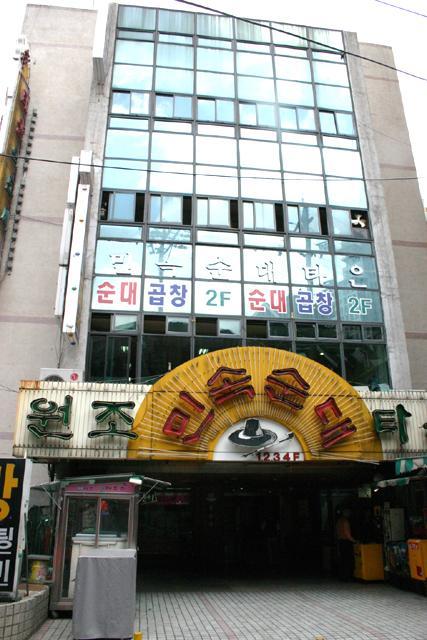
新林洞スンデ通り
新林洞スンデ通り Information / Directions
Category
Others (Eat out)
information
たんぱく質たっぷりの丸くて黒い韓国式ソーセージ、スンデ!
Powered by:navi.com
See more
Transit information
Please enter a station name
Please enter a station name
Search
Directions from [131]Jonggak to [S409]Seowon
Directions from [222/D07]Gangnam to [S409]Seowon
Directions from [424]Myeongdong to [S409]Seowon
Directions from [738]Soongsil Univ. to [S409]Seowon
See more
Nearest stations
1
[S409]Seowon
[S409]서원
311m
2
[230/S408]Sillim
[230/S408]신림
430m
3
[S410]Seoul National University Venture town
[S410]서울대벤처타운
969m
4
[229]Bongcheon
[229]봉천
1,060m
5
[S407]Danggok
[S407]당곡
1,065m
6
[S406]Boramae Medical Center
[S406]보라매병원
1,511m
Nearest places
漁父四時歌 / オブサシガ
ソウル市 冠岳区(クァナッグ) 新林洞(シンリムドン) 1640-30
028750097
Others (Eat out)
35m
27年伝統元祖スンデ(チョンドンウォンジョスンデ)
ソウル市 冠岳区(クァナック) 書院洞(ソウォンドン) 1640-38 ヤンジスンデタウン 3階
028767734
Others (Eat out)
35m
チャンチュ・チュオタン
ソウル市 冠岳区(カンアッグ) 奉天洞(ボンチョンドン) 735-5
028715431
Others (Eat out)
885m
セマウルシクタン (ポラメ公園店)
ソウル市 銅雀区(トンジャッグ) 新大方洞(シンデバンドン) 395-65 1階
028351025
Others (Eat out)
1,081m
ポラメ公園
ソウル市 銅雀区(トンジャック) 大方路(テバンノ) 219番地
0221811181
Park
1,536m
ヘテ食堂
ソウル市 冠岳区(クァナック)奉天4洞(ポンチョンサードン)894−5
028855398
Others (Eat out)
1,614m
オンジョンセントンカスジョンムンジョン 本店
ソウル市 銅雀区(トンジャック) 大方洞(テバンドン) 407-27
028238589
Others (Eat out)
1,796m
ジスアム-占-
ソウル市 銅雀区(ドンジャッグ) 上道洞(サンドドン) 248-11 2階
01049011499
Fortunetelling
1,895m
キムヨンヒ・カンナムトンテチム (テバン店)
ソウル市 永登浦区(ヨンドゥンポグ) 新吉洞(シンギルドン) 500
028493481
Others (Eat out)
2,006m
Nearest hotels
Sillim Holiday
28, Sillim-ro 59-gil, Gwanak-gu, Seoul Seoul Special City
25m
Hotel BaekDuGangSan
9, Sillim-ro 63-gil, Gwanak-gu
155m
Sillim Baegdu Gangsan
9 Sillim-ro 63-gil, Gwanak-gu, Seoul
158m
Sillim Aram
1593-6, Nambusunhwan-ro, Gwanak-gu, Seoul
169m
Trang blue hotel
52.sillim-dong 7 gil gwangak-gu Seoul
★★★☆☆
206m
MoMoStay
#103, 42, Nambusunhwan-ro 180-gil, Gwanak-gu
★★★☆☆
218m
Sillim Fore
#B103, 42, Nambusunhwan-ro 180-gil, Gwanak-gu,
221m
Trang Blue Hotel
52-1 Sillimdong 7-gil ,Seoul
234m
Sound Stay, 1 minute walk from Sillim Station, Netflix, 2 queen-sized beds, Hongdae 20 minutes, Remo
#B02, 39, Nambusunhwan-ro 180-gil, Gwanak-gu
★★★☆☆
237m
NAVITIME Transit
Asia
United Arab Emirates
Armenia
Azerbaijan
Bangladesh
China
Georgia
Hong Kong
Indonesia
Israel
India
Iran
Japan
Cambodia
Korea
Kazakhstan
Laos
Sri Lanka
Myanmar
Mongolia
Macau SAR
Malaysia
Philippines
Pakistan
Qatar
Saudi Arabia
Singapore
Thailand
Turkmenistan
Turkey
Taiwan
Viet Nam
Uzbekistan
North Korea
Europe
Republic of Albania
Austria
Bosnia and Herzegovina
Belgium
Bulgaria
Switzerland
Czech Republic
Germany
Denmark
Estonia
Spain
Finland
France
United Kingdom
Bailiwick of Guernsey
Greece
Hungary
Croatia
Ireland
Isle of Man
Italy
Lithuania
Luxembourg
Latvia
Moldova
Montenegro
North Macedonia
Netherlands
Norway
Poland
Portugal
Romania
Serbia
Sweden
Slovenia
Slovakia
Belarus
Ukraine
Russia
North America
Canada
Mexico
Panama
United States
Hawaii
South America
Argentina
Bolivia
Chile
Colombia
Puerto Rico
Ecuador
Dominican Republic
Brazil
Venezuela
Peru
Oceania
Australia
Guam
Africa
Algeria
Egypt
Mauritius
Nigeria
All in one map App
Rail map of the world with one application.
Select the country and download the rail map you want to use. The corresponding area is being expanded.
Tap Transit map
Route search by tapping rail map.
The operation is very easy. Just enter the departure and arrival by touching the rail map.
Offline
Can also be used offline.
It is safe even in areas with poor communication environment. Rail map and route search is possible even offline.
Map and Streetview
Station neighborhood maps give you peace of mind
The street view feature showing the area surrounding stations also allows the user to correctly confirm the location of each station.
DOWNLOAD THE APP
We use cookies on this site to enhance your user experience.
Privacy Policy
Accept


